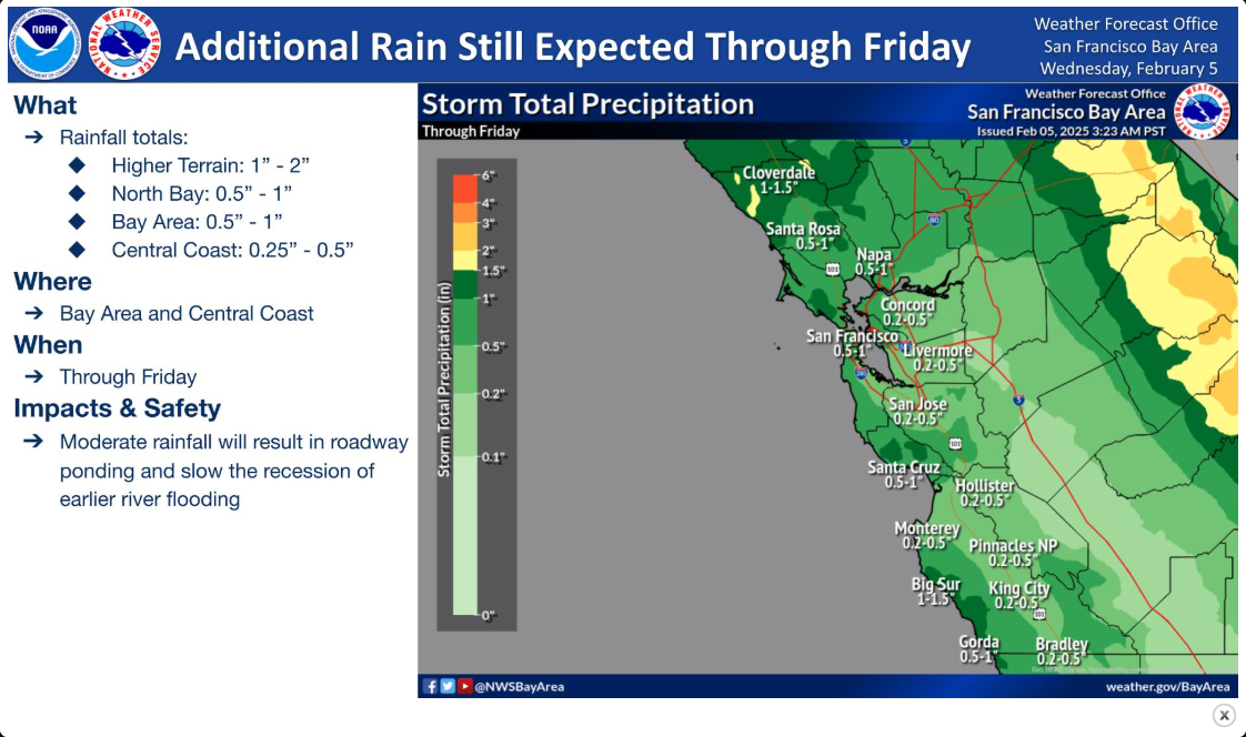
As of mid-afternoon on February 4, 2025 Sonoma Valley had nearly 6″ of rain during this current series of storms. The creeks are running high. Sonoma Plaza has some flooding.
Now NOAA has issued yet another Flood Watch for Thursday, predicting that the Valley may get more rain. With soil saturated and creeks still running high, flooding like that pictured below may happen again.

The National Weather Service has issued a Flood Watch, Monday, February 3, at 4 p.m. to Wednesday, February 5, at 4 a.m.

The risk of catastrophic floods exists every year and heavy downpours often lead to dangerous flooding conditions. Wildfires add another layer of risk during the rainy season because dangerous landslides and debris flows can rush down fire-scarred hillsides. Knowing how to prepare for a flood as well what to do during a flood can be lifesaving.

Heavy rainfall may lead to debris flows and flash flooding in and near recent burn areas, as well as creeks and rivers. Rapid ponding of water in urban and poor drainage areas is also possible. Cannot rule out mudslides/washouts in steep terrain.

Turn around, don’t drown! https://www.weather.gov/safety/flood-turn-around-dont-drown
For sandbag locations in the unincorporated areas of the county, visit the flood emergency homepage.


Be First to Comment