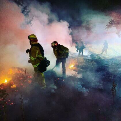
Though we’ve experienced some cooler temperatures and even some light rain this summer, looking out at the golden hills throughout this County makes it clear that the respite we had is over, the vegetation is dry, and fire season is here. Now is the time to check in with your loved ones, check your defensible space at home, and reevaluate and update your emergency plan.
Last month as I watched the news break on the Maui fires, I was brought right back to those moments from 2017, 2019, and 2020 that we are all familiar with—the panic and fear and smoke and sadness. My heart breaks for the people of Maui who have lost so much of their community. I know following the news out of Maui is triggering for us all here in Sonoma County, particularly as we approach our fire anniversaries. First and foremost, take time for yourself to process, and practice a little more grace with those around you.
In the years since the 2017 fires, there is a lot to grieve, but there is also a lot of good work to recognize. Through that devastating experience, people came together and met their neighbors, starting Fire Safe Councils or Map Your Neighborhood groups.
The County has continued to improve our Emergency Management programs, invest in vegetation management through community grants, and move towards a whole community approach for wildfire preparedness and resiliency. And community partners like the Fire Forward program, Sonoma Land Trust, the Resource Conservation Districts, Fire agencies, and more are working on fuel breaks, prescribed fires, and grazing programs to make our County more fire adapted.
In collaboration with numerous partners, we’ve also launched some exciting data driven mapping projects to help residents assess their risks, see vegetation management treatments that are planned or completed, and create custom maps: the Sonoma Wildfire Resiliency Planner, Sonoma Wildfire Fuel Mapper, and Sonoma County Community Wildfire Protection Plan Hub Site. Through Permit Sonoma, we are also running a variety of grants received through FEMA to help landowners in specified areas most at risk.
You should be familiar with Watch Duty by now, but if you’re not, this is a homegrown website and smartphone app created after the 2017 fires. They’ve recently expanded to cover more territory, added layers like air quality and wind direction, and have a specific icon for a prescribed burn (it’s green, instead of red). Posts are updated frequently as an incident develops.
PuslePoint, on the other hand, is a mobile app that is connected to the County’s 911 dispatch system called RedCom. It will display different icons for different types of 911 calls. Since landowners and agencies conducting controlled burns need to notify RedCom when they’re igniting a burn, all prescribed burns will show up on PulsePoint with a specific icon. These two real time resources are the best way to be notified of a prescribed burn, since conditions can change quickly and a planned burn can be called off or rescheduled.
Finally, please visit SoCoEmergency.org and review all the resources and tips in the Get Ready section to prepare yourself for whatever may come our way. This website is available in English and Spanish, and is continually updated and expanded; I make a habit to check it every few months. Make sure you are signed up for emergency alerts, have a go-bag ready, and know your evacuation zone. Another tip: find out about fire extinguisher training.
Above all, take care of yourself, your family, and your community, as these are what are most precious.


Be First to Comment