General Plans have become a routine part of planning; California state law requires, for example, a housing element that is reviewed every five years. Looking to the past to understand how our community envisioned its future and discovering what, if any, of that vision came to pass is generally rare. Thus the efforts and lessons of history are often forgotten.
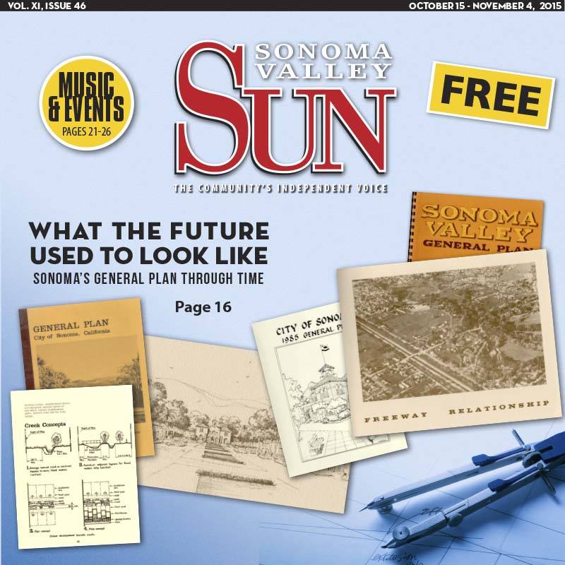
Here we take a peek at how the future looked in three past General Plans: 1964, 1974 and 1985. Of the three, the 1964 plan is a Valley-wide plan and the City of Sonoma comprises only a portion of it, but it’s notable for its long-range forecasts and its attachment to a future dominated by freeways. Had that vision come to pass, it’s likely our Valley would look more like the South or East Bay than the semi-rural oasis it is today. In other ways it and the other plans contain valuable insight worth recalling.
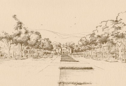
1964 General Plan – Approx 40 pages, plus maps and appendices
- Planning area was the entire Valley, not just the city.
- Assumptions include a major expansion of the City of Sonoma.
- Traffic Circulation was based upon creation of a Valley Freeway system, including designating Hwy 12 as a newly constructed North-South Valley Freeway with overpasses and transforming both 121 and 116 (Stage Gulch Rd) into freeways connecting to 101 and 80. “The Circulation System envisioned for the Planning Area places major emphasis on the utilization of proposed Freeways to carry through traffic and a substantial portion of traffic with origin or destination in Sonoma Valley.”
- Valley population in 1963 was 21,400, 4,000 of whom lived at SDC; future population was projected at 51,000 in 1985, and a total population capacity of 86,000 by 1995 based on the planning area.
- Rail service to North of the Plaza “will be maintained…providing existing industry and the Old Sonoma Zone with freight and excursion service.”
- Rights of way alongside freeways “are set at 300 feet width to provide space for rail-borne rapid transit in the future.”
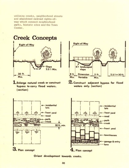
- In conjunction with the new Valley Freeway, the plan contemplates a 400-acre community park with a Southern feature near Hwy 121 of “a 40-acre boating and picnicking facility developed in conjunction with the Flood Control Channel” and an extended network of “riding and hiking trails.”
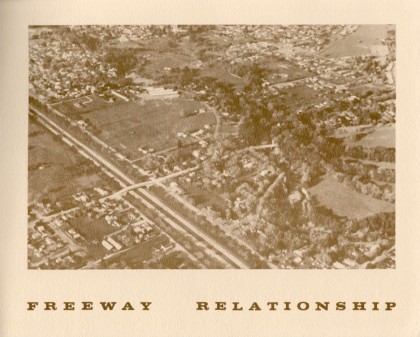
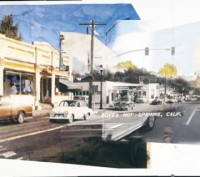
- Broadway is envisioned much as it looks today, lined with mature trees leading to the Plaza, and present buildings around the Plaza “retained and enhanced by addition of planter areas, street furniture and removal of overhead utility lines.” (see illustration)
- West Napa and Spain Streets “are components of a one-way loop system providing for internal circulation between the Plaza and Petaluma Avenue.”
- Support for the creation of a Central Business District “supplemented by Neighborhood and Local Convenience Shopping Centers.”
- Construction of a new City Hall, and “conversion of the present building to a Visitor Center and Museum.”
 1974 General Plan: 39 pages, including maps
- The Planning Area is the City of Sonoma only.
- The environment assumes prominence; “Sonoma has a good opportunity to preserve its wooded hills, its creeks, its rural atmosphere and small town character…changes in in state law and community attitudes towards growth have made the existing Sonoma Valley General Plan out-of-date.”
- Growth in population raises community “concern about typical suburban subdivisions of single family houses on small lots which reduce Sonoma’s semi-rural character…concern about large commercial centers of a type not compatible with Sonoma’s small-town character…also concern about preserving natural creeks, the lush backdrop of wooded hills and the long-range vitality of agricultural activities.”
- A focus on circulation and “concern about the volume of traffic which moves through Sonoma to outside destinations… and interest in the development of special paths and routes for pedestrians and bicyclists.”
- Includes Conservation Goals that “promote historic preservation…ensure historic continuity…protect Sonoma’s agricultural setting…and preserve natural areas.”
- City boundaries extending at least from Arroyo Seco to the East to Arnold Drive to the West and South to Hwy 121 and the slough on the Bay.
- The population projected for the City of Sonoma based on these new boundaries was 25,000 by 1995.
- Circulation changes do not include the new Freeways but retains the option of One-Way streets; rather, Hwy 12 is “re-designated from Broadway to Arnold Drive South of Petaluma Avenue.” Traffic downtown is routed east around the Plaza, West on Spain Street, and then connects to a proposed northerly extension of 4th Street West that connects with Verano Avenue. 5th Street West “should become one of the major internal traffic carriers within the city.”
- On Broadway and other avenues, “landscaping, in the form of installing boulevard-sized street trees along both sides of the streets should be used…”
- A new City Hall is again proposed, this time on an Northerly extension of 2nd Street West past West Spain Street.
- “Consolidation of the city water system with VOM Water District…is consistent with the implementation of a revised Sonoma Valley General Plan.”
- Pertaining to housing, the plan recommends higher-density housing be created, noting that, “Multi-family residential land … can provide the opportunity for having a sufficient supply of low cost owner units and low cost rentals.” Developments “with curvilinear streets should be discouraged.”
- Regarding tourism, “Sonoma enjoys, but does not depend on, tourism for an employment base. However, income brought to the community could be increased by providing additional lodging for weekend visitors.”
- As to the environment, “Sonoma has an obligation to protect its environmental heritage for enjoyment and use by future generations”, supports agricultural “greenbelts”, and protection of “habitat…for a variety of wild-life types.”
 1985 General Plan: Approximately 120 pages, including maps and appendices
- Retains several planning concepts to preserve Sonoma’s uniqueness; “the preservation of a greenbelt around the perimeter of the city’s urban core; the perpetuation of small scale buildings and the conservation of Sonoma’s historic buildings.”
- Recognizes “the increasing need to balance housing and jobs by providing more opportunities for development of smaller, more affordable units and an increase in local employment.”
- Acknowledges “tourism as a viable component of the city’s economy, yet also recognizes the desire of the community to keep Sonoma residential.”
- Outlines a “secondary sphere of influence” that “follows the area’s natural landscape features on three sides: Sonoma Creek on the west, the hill slopes on the north and Arroyo Seco Creek on the east.”
- Supports “the concept of developing a commercial center(s) in the unincorporated communities…to reduce commute traffic into the city of Sonoma.”
- As to water deliveries from the Sonoma County Water Agency, it notes: “The City’s current entitlement cannot be increased without developing a new delivery system for local supply source.”
- Projects a population in Sonoma of 12,500 by 2005 (currently at 10,600 in 2015, and the plan notes that ABAG projected a 2005 population of 13,900)
- As it pertains to traffic circulation, it notes: “Sonoma’s roadway system operates well below design capacity with the exception of West Napa Street between Broadway and Riverside Drive. These links are operating at capacity… noticeable driver delays are experienced at West Napa Street/Broadway, First Street West, Second Street West, Fifth Street West.” Plans for new signal lights at these intersections were planned.
- Other roadway improvements recommended: “Widen Hwy 12 to five lanes between 5th Street West and Riverside Drive” and “construct an alternate route that would attract traffic away from West Napa.”
- Included a “Tourism Element” to “establish the policy direction for future development of visitor-serving uses within the city.” Notably, a policy directed that “Any activity which advertises or directly promotes tourism will not be funded by the City” and that “the Plaza should be retained as the commercial service center for the community. Resident serving businesses…should be encouraged to locate in the Plaza.” TOT collected by the City in 1985 amounted to $49,360 (today TOT collections are over $2.4 million).
- A “Noise Element” set a goal to “Achieve noise compatibility between new and existing developments to ensure continuation of the prevailing quiet country atmosphere that residents associate with living in Sonoma.”


Be First to Comment